Geographic data from satellites, GPS-enabled mobile devices, social media, and environmental monitoring networks are increasingly important in research and policy-making in diverse areas, including business, transportation, environment, and health. At the same time, geospatial technologies are becoming deeply embedded in people's everyday lives and experiences.
Our Geographic Information Science (GIS) program examines the nature of geographic data, the tools and methods for analysis and modeling, and how GIS can be enable environmental and social transformations at the local, regional, national and global scales.
We emphasize methodological training in GIS as the foundation for understanding and modeling these processes and for developing innovative new tools and methods. We also foster critical awareness of the roles of geospatial technologies in society. Areas of research emphasis include: CyberGIS, Big Data analytics, geovisualization, spatio-temporal analysis and modeling, analysis of human mobility (e.g., GPS trajectory analysis), satellite remote sensing, critical and qualitative GIS, spatial analysis, and GIS applications in ecology, health, urban studies, transportation, emergency response, fluvial geomorphology, and environmental justice.
Faculty and students have strong connections with many campus units, including:
- Blue Waters/National Center for Supercomputing Applications
- Department of Computer Science
- Prairie Research Institute
- Department of Urban & Regional Planning
Program Information for Prospective Graduate Students
Faculty working in Geographic Information Science


Related News
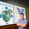 Nearly 69 million people in the United States speak a language other than English at home, yet weather warnings have long been issued almost exclusively in English. A new study documents how the...
 How can AI and data science help solve some of the world’s most complex environmental and societal challenges? In this Q&A, professor of geography and...
-
Shaowen Wang issues this straightforward invitation: Your perspective is needed now more than ever.He’s encouraging you to attend the Sustainability Research and...
 Marynia Kolak is a professor of geography and geographic information science and principal investigator for the...
 The United States Geospatial Intelligence Foundation (USGIF) has granted accreditation to the University of Illinois at Urbana-Champaign for the fully-online graduate...
 On any given drive across the countryside you may see cornfields or a forest. Dr. Chunyuan Diao sees a complex terrestrial ecosystem that can provide clues to improving food security, climate...
- A yearlong investigation reveals the air quality in Cicero is “much worse” than in surrounding Cook County neighborhoods. The project involves sensors installed and monitored by the Cicero...
- It's a busy day anywhere in the world. You roll out of bed and grab your smartphone. You check a news website or a weather app or look up directions to an appointment. Most people don't think about...
 How did you decide to become a geographer? I am a physical geographer interested in the hydrosphere and its interactions with human societies. Like many others, my academic...
 Congratulations to Dr. Chunyuan Diao on receiving the University Consortium for Geographic Information Science (UCGIS) Early/Mid Career Research Award, presented at the annual Symposium at Yale...