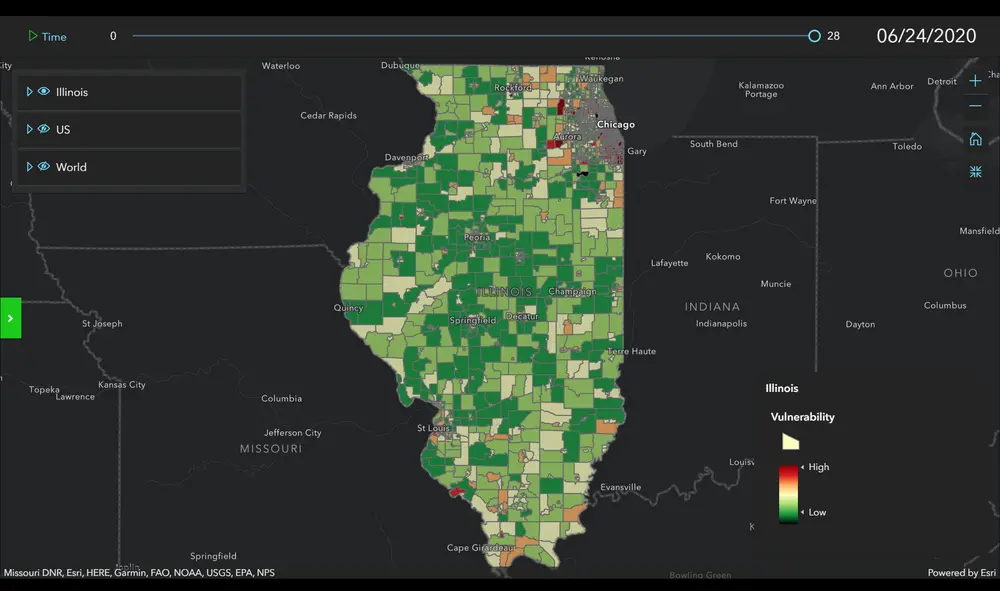
The CyberGIS Center for Advanced Digital and Spatial Studies at U of I has teamed with the state of Illinois to produce a system of interactive maps, charts, and animations to better help understand and prevent the spread of COVID-19.
Called WhereCOVID-19, the project aims to support decision-making in regards to COVID-19 by answering critical “where” questions: where cases are and will likely be; where vulnerable populations live; where containment measures should be applied; where health care services might be overwhelmed; and where additional testing and other health care resources should be deployed.
By relying on a variety of data sources, including COVID-19 case counts from the Illinois Department of Public Health (IDPH) and analyses of population characteristics and the availability of health care resources, the makers of WhereCOVID-19 have created an interactive online platform with mobile device support that allows users to obtain information about the spread of the coronavirus around the state, nation, and world.
The WhereCOVID-19 platform is made available to a broad range of stakeholders, research and education communities, policy makers, and the public in general. A mobile app for the platform is scheduled for release this week.
The project was created under the request of the U of I President's Office and the Illinois Governor’s Office. It is being led by Professor Shaowen Wang, head of the Department of Geography and Geographic Information Science and director of the CyberGIS Center; Professor Sara McLafferty; Vincent Freeman, professor of biostatistics and epidemiology at the University of Illinois at Chicago; and Bill Jackson, director of the Discovery Partners Institute (DPI).