From Mountains to the Sea: Watershed Science and Management in the Coastal Pacific Northwest, our department’s first field course in many years, provided students with a unique opportunity to explore stunning geomorphological landscapes, learn state-of-the-art field techniques, and consider the applications of these techniques to hazard assessment, landscape management, and infrastructure planning.
Professors Piotr Cienciala and Jim Best co-taught the two-week course, hosted by Quest University – a new campus in British Columbia (BC) perched on a mountaintop with sweeping views across the Squamish Valley toward Howe Sound, a picturesque fjord on the rugged coast.
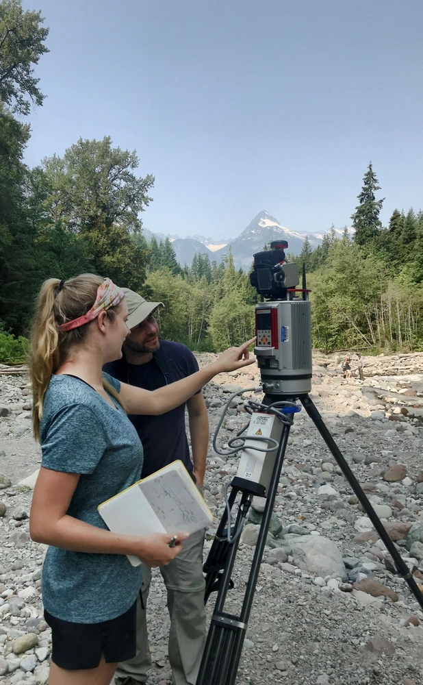
They led a diverse group of nine undergraduates and graduate students, integrating field excursions with background lectures, discussions, and presentations that detailed the area’s geomorphology. They also introduced approaches to field research and data collection including ground-based LiDAR (Light Detection and Ranging), Ground Penetrating Radar (GPR), electromagnetic flow measurements, and structure-from-motion photogrammetry.
Cienciala and Best engaged local experts and educators to help develop the course, and to give our students a first-hand look at variety of career paths in environmental science. Andrew Nelson of Northwest Hydraulic Consultants and Edith Tobe, Executive Director of the Squamish River Watershed Society shared their perspectives on watershed management issues; and Professor John Clague of Simon Fraser University in Burnaby, BC, generously shared his deep knowledge of the dynamic local landscape
Field days were based in both the Squamish and Pemberton valleys, drained by the Squamish and Lillooet Rivers respectively. The group examined Squamish Valley’s Holocene evolution, from volcanic eruptions under thick ice sheets and ice-contact lava flows to construction of alluvial fans and the deposits of large landslides and debris flows under deglaciating conditions. Edith Tobe led the group on a tour of ongoing watershed and habitat restoration projects; emphasizing the importance of understanding landscape history and processes, and especially how poor land use practices can lead to ecosystem degradation.
In the Pemberton Valley, the group observed the products and effects of the 2010 Mt. Meager Landslide, one of the largest ever recorded, that introduced a massive quantity of sediment into the upper ends of the valley. The class studied and debated the landslide’s deposits and the subsequent geomorphic changes within the Lillooet River corridor. They also considered implications for channel management such as changing flood risk, channel aggradation and levee construction, and sediment yield into Lillooet Lake.
The interdisciplinary nature of the field course allowed students to apply lessons to a variety of educational and professional goals. “I hadn’t studied physical geography or geology before, so conducting this field research taught me valuable skills and showed a different perspective on complex human geography questions by focusing on geomorphology,” said geography & GIS/economics double major Asif Ali.
“This course taught me to appreciate the amount of work and logistical processes involved in acquiring, managing, and processing remote sensing datasets. I will forever remember the picturesque field sites that we had the privilege of working in, especially considering we were the first to use such awesome field technologies in these areas,” said geography & GIS major and Roepke research scholar Matt Blaser.
The group produced a range of excellent ideas, interpretations, and data, which they presented to each other at the end of the course. Students also wrote individual reports concerning landscape evolution and contemporary environmental management. Geology major McKailey Sabaj found the field course extremely beneficial as she considers a career in environmental geoscience. “I had a great time on the trip and was able to connect my previous knowledge of geomorphology with a new landscape. Thanks for the experience!”